"The Get Out the Vote" Early Voting Block Party
July 25th 9am-5pm. Early Voting starts July 25th thru August 2nd. Click here for more information.

block-detroitminew-views-block-news-events-block-1,News & Events*block-detroitminew-views-block-related-links-block-1,Related Links*block-detroitminew-views-block-video-playlist-block-1,Videos*documents-block,Documents*block-detroitminew-views-block-forms-block-1,Forms*block-views-block-faq-block-1,FAQs*block-detroitminew-views-block-district-map-block-1,District Map*block-views-block-council-office-directory-block-1,Office Directory*block-detroitminew-views-block-contacts-block-3,Contacts*block-detroitminew-views-block-contacts-block-4,Contacts*block-detroitminew-views-block-council-member-bio-block-1,Bio*block-detroitminew-views-block-sub-sections-block-1,Sections*block-detroitminew-views-block-web-apps-block-1,Web Apps*block-detroitminew-views-block-news-events-block-4,News*block-detroitminew-views-block-news-events-block-3-2,Events*block-detroitminew-views-block-contacts-special-block-1,Staff*block-detroitminew-views-block-statements-block-1,Statements*block-detroitminew-views-block-newsletters-block-1,Newsletters*block-detroitminew-views-block-newsletters-block-3,Ordinance*block-detroitminew-views-block-newsletters-block-2,Resolutions*block-detroitminew-views-block-newsletters-block-4,Memos
The City of Detroit supports the safe, respectful, and legal use of drones in our community—for recreation, education, and innovation. The FLYSAFE initiative provides residents, visitors, and businesses with up-to-date information on where and how to operate drones safely. Here, you’ll find tools, resources, and local information to help you plan safe flights in accordance with Federal Aviation Administration (FAA) rules.
For details on certifications, operational guidelines, and authorizations, visit the FAQ & FAA Resources section below.
The FLYSAFE program empowers the community to:
Through Airspace Link’s AirHub® Portal, pilots can view safety advisories, check local conditions, and request FAA flight authorizations within minutes.
Note: Detroit FLYSAFE does not capture personal information or live video. All displayed data is sourced from the FAA and City-approved systems.
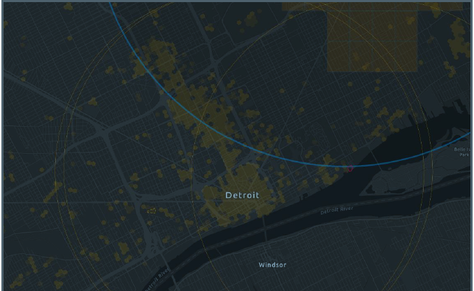
Use the interactive map below to explore Detroit’s airspace. View local advisories, restricted zones, and FAA charts—all in one place. This tool informs of where drone flights are permitted, restricted, or require authorization. Areas are color-coded to reflect different airspace rules. Click on the map for more details and always confirm your flight plan using FAA-approved tools.
For drone delivery, Unmanned Aircraft Systems (UAS) operations, or Advanced Air Mobility (AAM) infrastructure and support in the region:
Contact the City of Detroit
For program participation, data sharing, or operational permissions.
Contact Airspace Link For enterprise tools, integrations, or training with AirHub® Portal and FLYSAFE systems.
Ensure you have a valid FAA TRUST Certificate (recreational) or Part 107 Remote Pilot Certificate (commercial).
All drones weighing more than 0.55 lb must be registered with the FAA.
Register as a drone pilot in the AirHub® Portal. Once registered, you’ll have access to up-to-date airspace information and can submit flight authorization requests through LAANC.
Locate your flight area using an address, coordinates, or the interactive map. Define operation details such as altitude, start time, and flight area.
Submit your request AirHub® Portal for near real-time FAA approval to operate in controlled airspace under 400 feet.
The Recreational UAS Safety Test (TRUST) is required for all recreational drone pilots in the U.S. It ensures pilots understand basic safety and airspace rules before flying. The free online test can be completed in about 30 minutes through FAA-approved providers.
Coleman A. Young International Airport
[email protected]